Key Details:
- Length: 128 km (80 miles) approx.
- Starting Point: Rubha Hunish (North).
- Ending Point: Broadford (South).
- Typical Duration: 6-7 days.
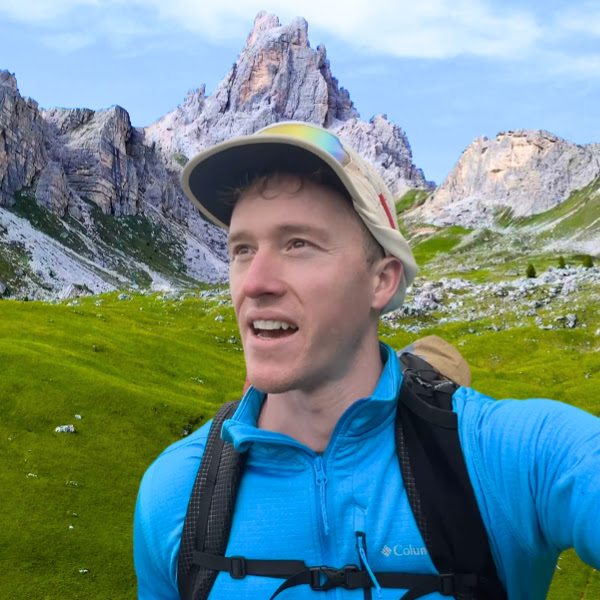
As an Aussie who grew up in rural Queensland I’ve always been attracted to the beautiful wilderness in this amazing country of Scotland. I first visited in the summer of 2020 and then again on this trip (end of June/early July 2021. After visiting Skye on our first Scotland trip I made a promise to myself I would return to tackle this trail. Below is my story about being on the trail and my experiences. I completed this trail over 6 days, wild camping for 4 nights and spending 1 night in a bnb in Portree. I moved quite slow as I was filming and taking some landscape photography for most of the time.
Pre-Hike
After a miserable winter working in the ICU of a north London hospita during covid lockdowns l I knew I had to spend my summer in the outdoors tackling a few trails. At the end of June I quit my full-time physio job as I was due to start a new role in early August, leaving me with 6 weeks to run-amock. I had a few trails in mind that I wanted to tackle over the summer, but ever since my first trip to Skye I have felt something drawing me back…decision made. I booked everything last minute and made my way from the manic chaos of London via plane to Inverness. I had a caffeine hit at Velocity cafe before I got the CityLink bus to Skye. Clear skies and a decent forecast left me with quite a buzz (or maybe that was just the coffee). I arrived to the wonderful Shiloh B&B run by Sheila and Malky in Breakish, who were kind enough to hold onto a bag of fresh clothes for my return the following week. I ate at the Red Skye restaurant in Breakish (an amazing 3 course meal – too much for one person but I’ll use the excuse of energy stacking) and probably 4 too many wines. I stumbled home to call it a night and await the big day.

Day 1 (Duntulm to the Quairang)
- 22km (13.8 miles)
- 948m of Elevation
The first day started with a 3km walk to the Broadford post office bus shelter to get the 52 bus to the isle’s capital, Portree, at 8am. At the bus stop I got speaking to a Hungarian fellow based in Cheshire who was also doing the trail. We got to Portree, paid a quick visit to the great Inside Out camping store for some supplies and gas, and then got the next bus to the little red phone box at the the trail head at the north eastern tip of the island in Duntulm. We set off towards our first major landmark: the old coastguard bothy (a bothy is a small unmanned house/structure, dotted throughout Scotland’s wilderness for hikers and travellers to sleep and seek shelter in) and the Rubha Hunnish headland.
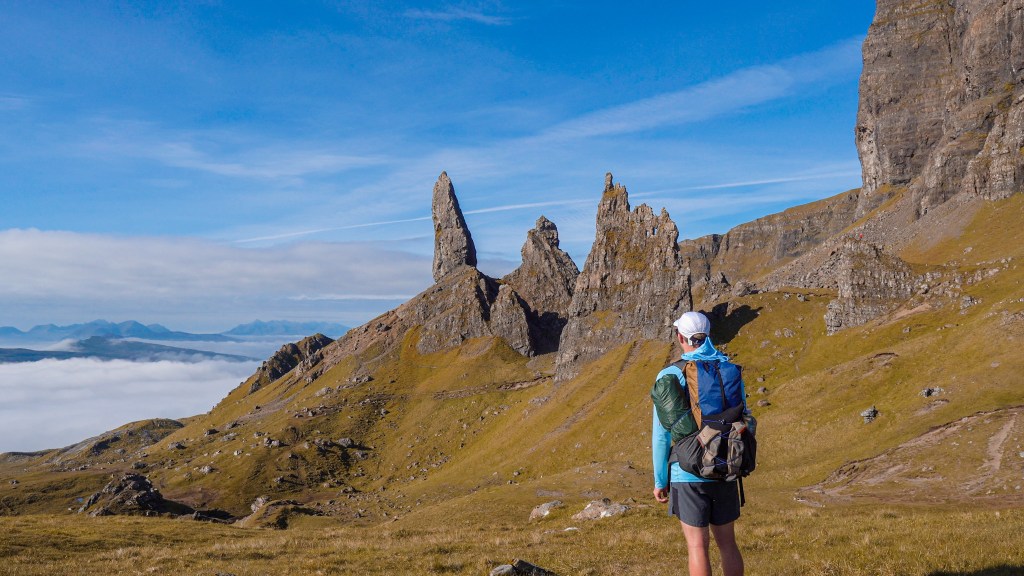
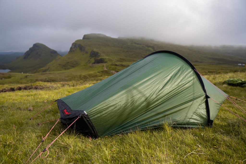
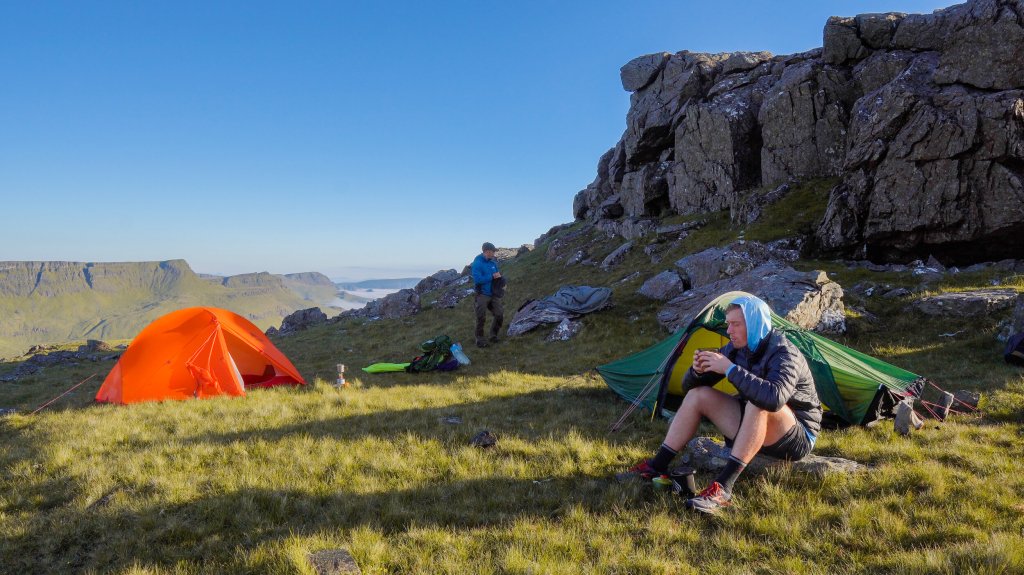
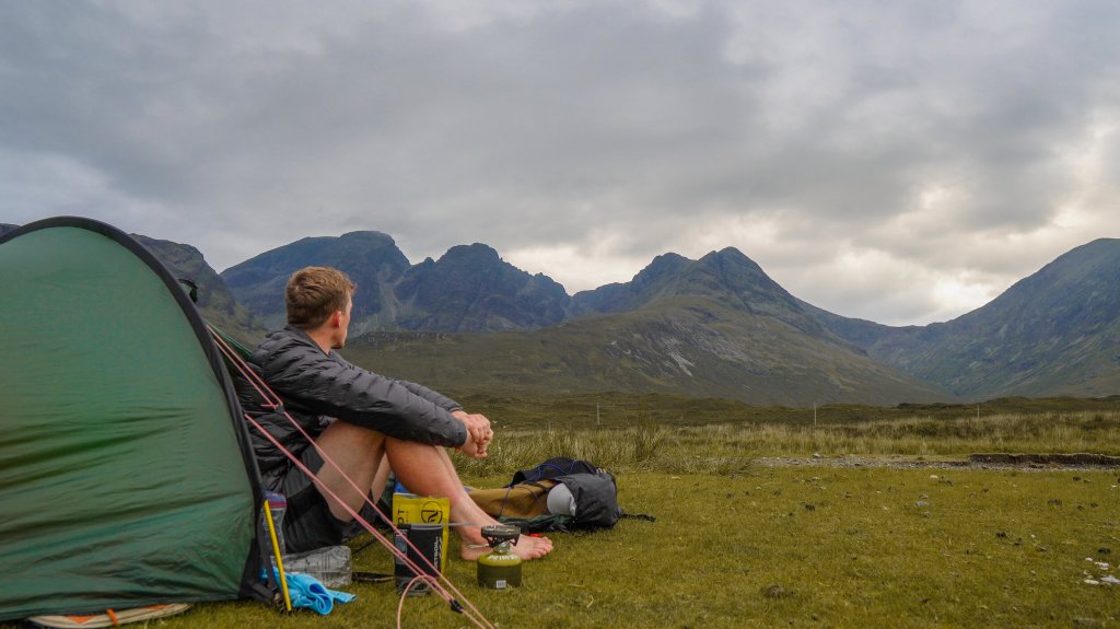
Next was walking along the coast towards the small settlement of Flodigarry. Previously, the Flodigarry Hostel would make a very inviting establishment for a drink or a bed for a wary traveller tackling the trail, but due to reasons beyond control the hostel was unfortunately not operating. We stopped briefly at the Flodigarry hotel instead for a quick pint, before we pushed on and ascended up into the Quairang. The Quairang is an ancient landslip which has resulted in a very unique landscape and ridge formation. We pushed up and along, before we descended slightly, 20 minutes or so prior to the Quairang parking area, where we found some flat ground that we would camp on (note in Scotland you have the ability to wild camp where you like – just remember: leave no trace).
Day 2 (The Quairang to the Storr)
- 23km (14.5 miles)
- 1,316m of Elevation
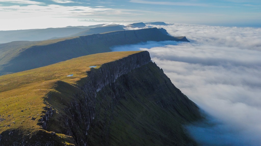
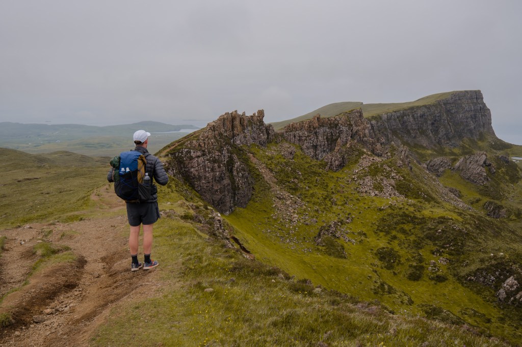
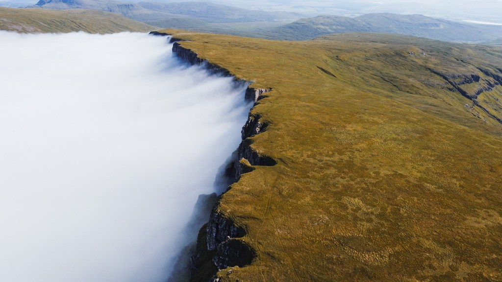
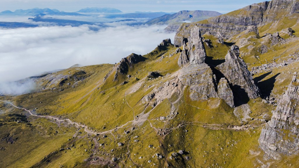
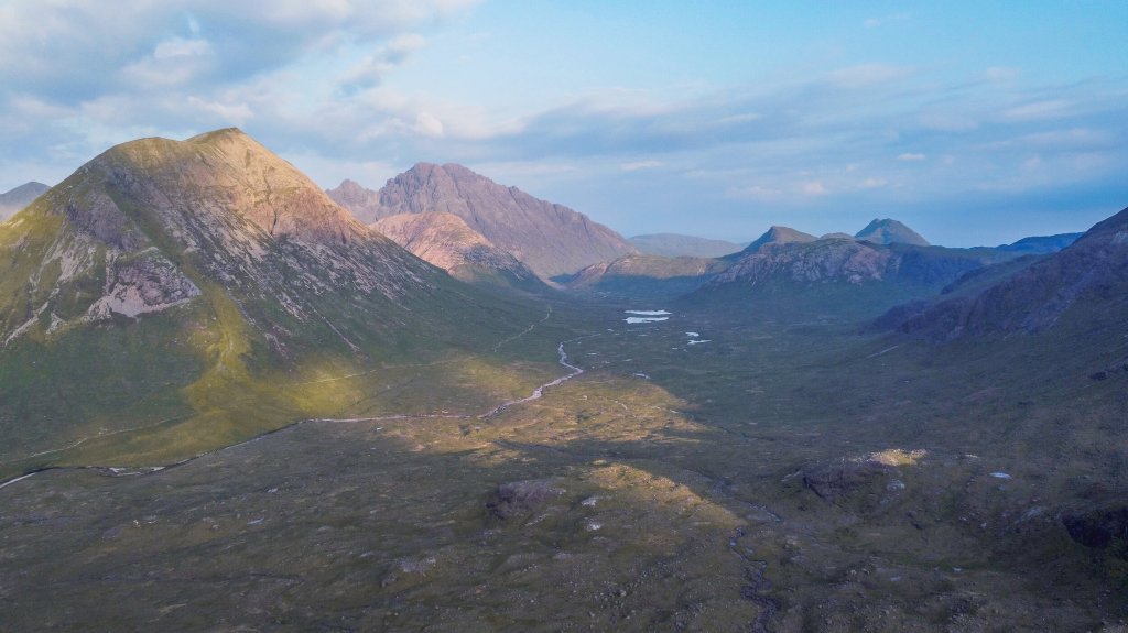
The next section, in my opinion, would be the toughest. We would traverse the infamous Trotternish ridge, which like the Quairang, is a giant, ancient landslip extending from the north to south. We were initially met with thick fog which would condense into rain and resultantly terrible visibility. We were also slowed down considerably by the multiple bog pits that we had to cross. It should be noted that a path to follow, and any form of way-marking, is mostly non-existent along this section. Luckily, I was using the Alltrails app on my phone and had downloaded the Skye Trail map for offline use with GPS. Without it, we would never of completed the section through the thick fog and rain..
After some time though, the rain dissipated and the fog began to clear, and we were gifted with some of the most amazing views of the ridge and the surrounding landscape.
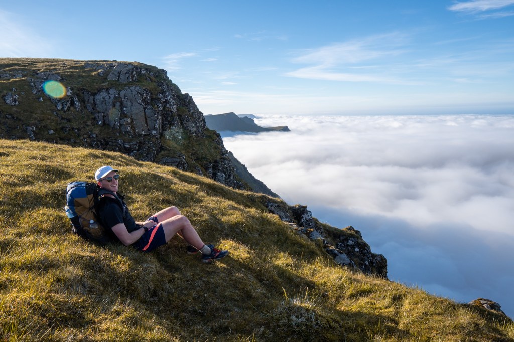
After many summits accompanied by amazing views as you can see above, we started coming closer to the Storr; a massive rocky hill section of the ridge. We descended slightly and found a spot to camp for the night.
After a tiresome day of difficult navigation, rain, bog and a decent amount of elevation we we exhausted, and crashed quite quickly after our freeze dried meals.
Day 3 (The Storr to Portree)
- 18km (11.2 miles)
- 528m of Elevation
The next morning we were gifted with an easier days walk compared to the previous. We would descend down to the Needle of the Storr and then down further to a lower ridge walk that would take us to Portree. We had a late start that was accompanied by a few coffees, but we soon got going in sunny weather. Our first stop was the Needle which we had mostly to ourselves, surprising given normally there would be tourists everywhere.
Our next section was to descend down to the carpark for the Needle and walking on the road for 20 or so minutes before we would then move back onto the trail and begin to ascend a lower ridge-line that stretches along the coast. The sun was beaming and we were loving life.
On reaching Portree we treated ourselves to a good serving of fish and chips, followed by some good coffee and cake, all topped off with a few pints at the Granary. After this we parted to our respective sleeping quarters for the night; me at a bnb I had pre-booked and Lasslo at the Hostel in the centre of town.
Day 4 (Portree to Sligachan + Exploring the Cuilins)
- 27km (17 miles)
- 755m of Elevation
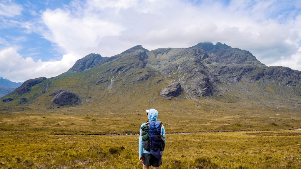
The next section of the trail is probably the least pleasant in terms of views. It involves a large section of road walking after leaving Portree and slow moving over rocks as you travel along the shores of a Loch. The end destination is the small settlement of Sligachan which has a few shops and is situated at the base of the Red and White Cuilins, 2 mountain ranges that we would pass through the following day. Once we had set up camp along the river in Sligachan, I went out to do a little bit of exploring at the base of the Red Cuilins, before having a quick dip in the river.
Day 5 (Sligachan to Elgol to Torrin)
- 34.5km (21 miles)
We soon learnt that the next few days would potentially have some wetter weather. We discussed our options and the possibility of finishing the trail early. The official guidebook recommends 7 days of walking. Lasslo was determined to finish today (day 5), whilst I knew I would take longer due to my filming, and would instead aim to finish tomorrow (day 6). With that, we said our goodbyes to each other, after sharing such a great time on the trail together.
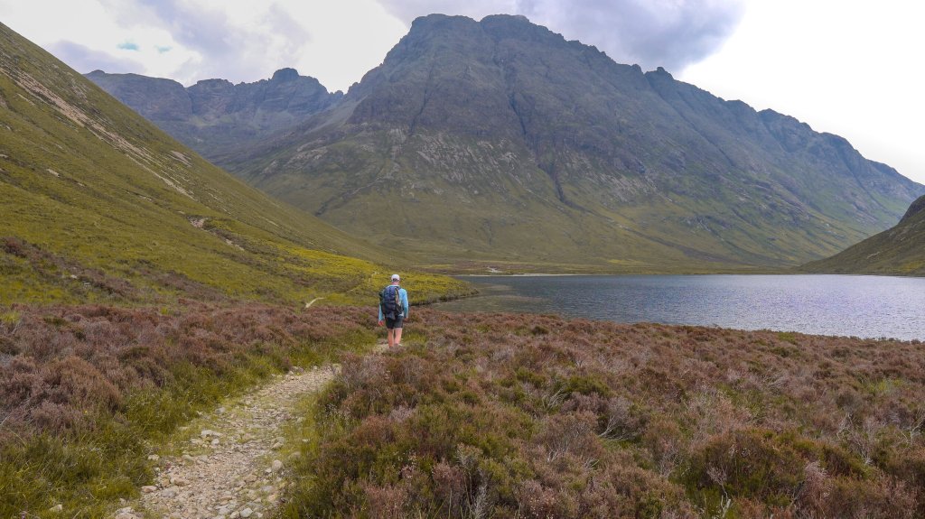
My day 5 would consist of walking to the small town of Elgol, where I planned to stop at the small shop for snacks and coffee to help me push on to the small town of Torrin to wild camp at. Sligachan to Elgol included walking between the White and Red Cuilin mountain ranges, which was very scenic. Following this there is a stretch of coastal hiking alongside a cliff, which in poor weather could be questionable. There was quite a bit of overgrowth which made for slow walking, and this section felt like a slog.
Reaching Elgol was a welcoming break after the coastal section, where I sat at the local small shop run by a young lass from one of the neighbouring villages. I grabbed a flat white with an extra shot, 3 bars of chocolate and some sandwiches and sat in silence whilst I devoured them. I still had another section to battle through, usually completed on a seperate day. But I still felt fresh and the long summer daylight hours of Scotland would permit these sorts of long days on the trail.
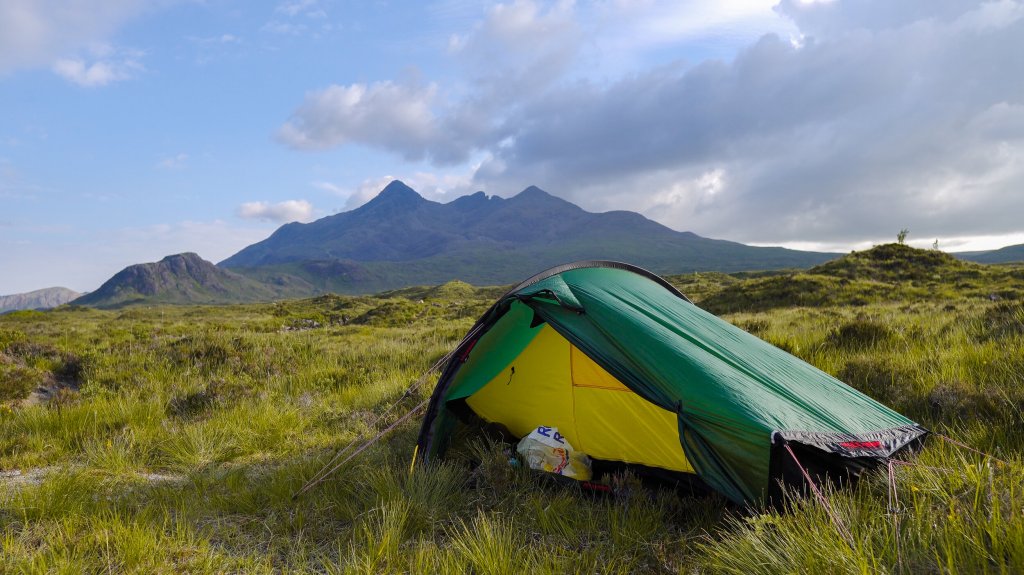
The next section, Elgol to Torrin, is an interesting one. It is a mix of road walking but combined with some beautiful scenery as it winds around the other side of the White Cuilins. I eventually started to descend slowly towards the town of Torrin, where I spotted a suitable wild camping spot on the the bank by the Loch.
Day 6 (Torrin to Broadford)
20km (12.5 miles)
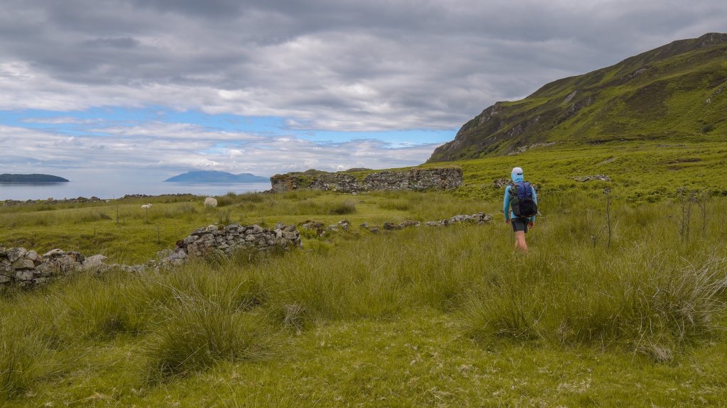
And my final day, Torrin to Broadford, was quite a straightforward half-day hike along the coast, passing through the ruins of Boreraig, an old settlement that was affected by the Highland Clearances. It was quite an eary experience walking through the ruins, and a sad reminder of those who were displaced from their homes some hundred years ago.
The final stretch to Broadford was an easy incline and then a long, windy path, that eventually joined a road that took me to the outskirts of Broadford, the offical end of the trail. After 6 days, 5 nights, 91 miles and 5,336m of elevation, my hike was concluded.
Though a challenging hike, I thoroughly enjoyed it, most notably the first half of the trek, particularly along the Quairang and the Trotternish Ridge. it is more isolated then say the West Highland Way, and hikers could find themselves in a sticky situation along the ridge in poor weather. Though the scenery and views are ubmatched, which is why this is one of my favourite hikes to date.
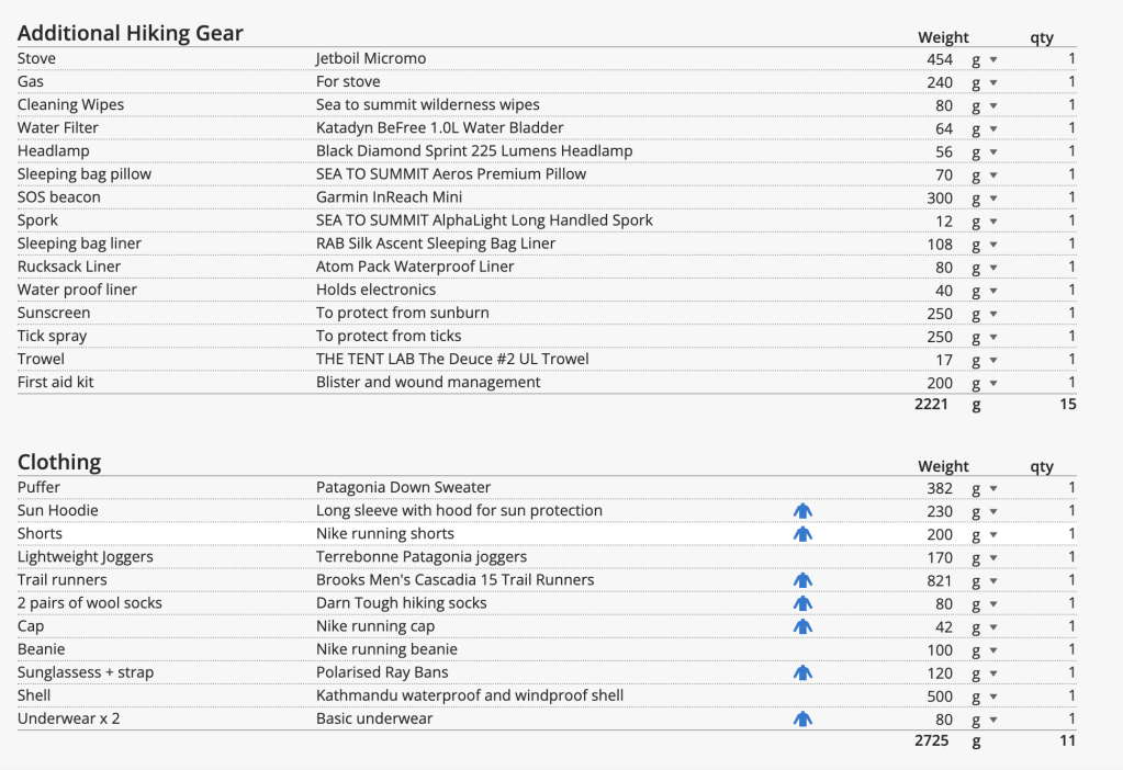
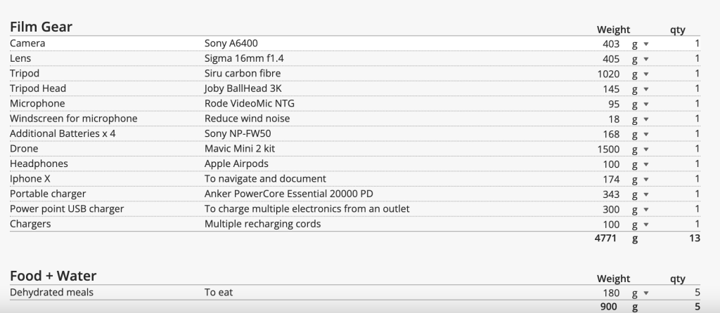
Below you can find some more details on my stats for the hike and gear used and weight.


Leave a comment